External Winter Storm Update from DESPP / DEMHS

January 26, 2015

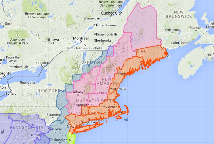
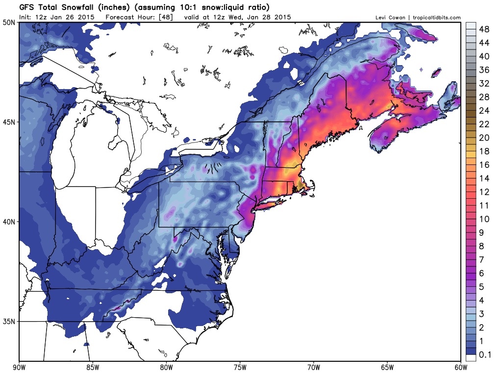
The National Weather Service has issued a Blizzard Watch for all of Southern Connecticut for Monday afternoon thru Tuesday night.  A long duration (36-hour) very high impact (Blizzard) Northeaster is currently expected.  Please see the attached preliminary snowfall forecast.

Here’s a detailed forecast based on the current weather models:

NWS Map 2Monday…A weak clipper system is forecast to move east off the North Carolina Coast Monday morning.  Light snow is forecast to spread into Connecticut between 10:00 AM – 2:00 PM.  The light snow is forecast to increase in intensity during the afternoon reaching a moderate level by 4:00 PM. The impact on the afternoon commute is currently expected to be minor to moderate with a dry powdery snow cover on most roads of around 2 inches.

Monday Night…The storm rapidly intensifies and turns due north (still 150 miles off the coast).  Snow is expected to become heavy (snowfall rates 2 – 3″ per hour) by midnight with strong NE winds gusting to 40 MPH inland and 60 MPH at the coast.  Near blizzard or blizzard conditions can be expected overnight with temperatures in the upper teens and wind chills near 0 F.  Considerable blowing and drifting of snow with a major impact on all travel.

Tuesday…Blizzard conditions thru the morning (snowfall rates up to 4″ per hour) with the snow intensity forecast to lessen to a moderate level by early afternoon.  Continued windy during the afternoon with moderate snow falling and gusts to 40 MPH inland and 60 MPH at the coast.  Considerable blowing and drifting of snow with highs only in the low 20’s.  Major impact on all travel during the day.

Tuesday Night…Snow ending by midnight with total accumulations ranging between 24″ – 36″ (locally higher amounts over 40″ are possible in Eastern CT).

The Department of Emergency Services and Public Protection Division of Emergency Management and Homeland Security will continue to monitor this very serious storm

Gov. Malloy: Take Necessary Precautions for Possible Blizzard Conditions

NWS MapBlizzard Warning Issued for Entire State, Coastal Flood Watch Also in Effect for Entire Shoreline

(HARTFORD, CT) – With the latest forecast calling for blizzard conditions across parts of the state, Governor Dannel P. Malloy is asking residents to be prepared and take the necessary precautions for a significant snowstorm that will impact the state Monday evening through Tuesday.

“Although storms can be unpredictable, this storm has the potential to have a significant impact on the state and we need to be prepared,” Governor Malloy said. “Just as the state is monitoring and preparing, the public should do the same.”

“The Division of Emergency Management and Homeland Security (DEMHS) is monitoring this storm very closely and is prepared to coordinate any potential state response,” Department of Emergency Services and Public Protection Commissioner Dora B. Schriro said.

DEMHS is also participating in National Weather Service conference calls to get the latest information on the storms track and is sending out regular updates to all municipalities and tribal nations.

The Connecticut Department of Transportation will have its entire fleet of snow plows, including 12 loader-mounted snow blowers, prepared to deploy.  The residual road treatment from the previous weekend storm will help in the efforts to pretreat the road

Governor Malloy will be providing the state with additional updates as conditions warrant.

In order to be prepared for any type of emergency situation, the Governor encourages residents to have an emergency supply kit and follow some basic preparedness tips.

   Additional preparedness tips:

  •     In the event emergency travel is necessary, fill up your car with gas, check oil and windshield fluid levels
  •     Sign up for emergency alerts at www.ctalert.gov
  •     And always, check on your neighbor

For additional info on winter weather preparedness go to www.ct.gov/demhs or www.redcross.org.

Words That Describe Us: Volume 46

Aetna Ambulance Service, Inc. - Ambulance Service of Manchester, LLC.MANCHESTER and HARTFORD — Aetna Ambulance and ASM send Patient and Customer Satisfaction Surveys to a random sampling of patients who have received emergency or STAT inter-facility services from our companies.

The final question in the survey asks “Do you have any suggestions on how we can improve our service?” And, “Please use one word to describe us.”

Some of the answers/responses included:

  • Outstanding! Thank you!
  • Professional, provided clear analysis of the situation. (14-98987; R. O’Neil, M. Kleza).
  • Caring professionals. May very well saved my life – provided excellent, timely care. My thanks to the team who were so considerate especially on Thanksgiving Day. (14-101886; R. O’Neil, M. Kleza, K. King).
  • Work very well together!
  • A great experience overall.
  • Excellent, very considerate.
  • In good hand[s]
  • The crew was excellent
  • Courteous, caring, treated with dignity. (14-104270; T. Oliver, S. Meckel with Manchester Fire Rescue EMS).
  • Cordial + caring.
  • Courteous, kind + professional. Very serious medical workers. (14-104171; T. Cote, L. McHugh with East Hartford Fire Department).
  • Professional, Personable, Empathetic. (14-103960; A. Gomme, L. Slebodnick).
  • All in all very courteous + professional.
  • As a veteran at ambulance rides – ONE OF THE BEST! (14-100555; J. Bak, N. Raiola).
  • Courteous, efficient, capable. (14-103131; E. Sheils, S. Boutot).
  • Good.
  • I would recommend your service to others.
  • Caring + calming.
  • Professional
  • Very caring.
  • They did a superb job; really professional.
  • Professional, empathetic & non-judgmental. (14-105968; M. Tuttle, R. Fross).
  • Friendly, calm, responsive. (14-106114; M. Tuttle, M. Khan).
  • Excellent service!
  • Very professional + courteous + beyond – put me at ease – even looked in on me (at ER) at end of day! (14-105672; D. Noyes, R. Dunn).
  • Professional, kind + caring.
  • Was most satisfied.
  • Very ppt. + professional.
  • Caring + professional.