
 UPDATE from the Department of Emergency Services and Public Protection:
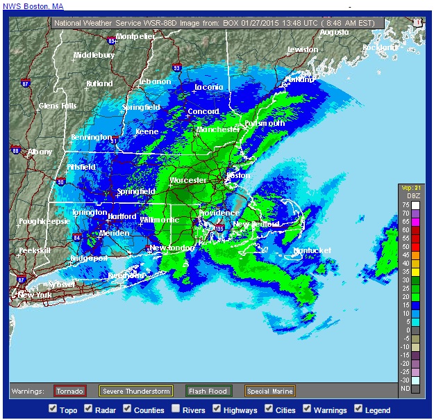
At 4:45 AM the radar continues to show bands of Moderate snow sweeping from the south east to the west.
Temperatures are mostly in the teens with some sites along the coast in the low 20’s.
Winds out of the north east are gusting to near 40 MPH.
The most recent snow fall reports of 2 to (almost) 11 inches verifies the presence of the more moderate bands of snowfall in the eastern and central portions of the state.
- Marlborough – 10.8
- Manchester – 7.5
- Coventry – 6.5
- Thompson – 8.2
Three-quarter to one-quarter mile visibilities also verify the moderate snowfall.
Some drifting has been reported.
The total snowfall forecast may need to be adjusted downward. One to two foot snowfall totals are still possible with this storm – particularly for the eastern half of the state. The western side of the state will probably see snowfall totals between 3 and 12 inches.